Total Pageviews

Sunday, November 15, 2009

Castle of the Teutonic Order in Malbork

Card # 39 This postcard sent to me by Kazimierz

The Castle in Malbork was built in Prussia by the Teutonic Order as an Ordensburg. The Order named it Marienburg, literally "Mary's Castle". The town which grew around it was also named Marienburg, but since 1945 it is again, after 173 years, part of Poland and known as Malbork.

The castle is a classic example of a medieval fortress, and is the world’s largest brick gothic castle. UNESCO listed the castle and its museum as World Heritage Sites in December 1997 as Castle of the Teutonic Order in Malbork. It is one of two World Heritage Sites in the region with origins in the Teutonic Order. The other is the Medieval Town of Toruń, founded in 1231 as the site of the castle Thorn. Read more

Post WWII ruins of the castle

Information and Image Obtained From Wikipedia, the free encyclopedia

Monday, November 9, 2009

Cracow's Historic Centre

Card # 38This postcard sent to me by Kazimierz


Kraków is one of the largest and oldest cities in Poland and a popular tourist destination. Its historic centre was inscribed on the list of World Heritage Sites as the first of its kind. Situated on the Vistula river in the Lesser Poland region, the city dates back to the 7th century. Kraków has traditionally been one of the leading centres of Polish academic, cultural and artistic life, and is one of Poland's most important economic centres. It was the capital of Poland from 1038 to 1596, the capital of the Grand Duchy of Kraków from 1846 to 1918, and the capital of Kraków Voivodeship from the 14th century to 1999. It is now the capital of the Lesser Poland Voivodeship. Read more

Grand-Place, Brussels

Card # 37This postcard sent to me by Johan

Grand Place (French) is the central square of Brussels. It is surrounded by guildhalls, the city's Town Hall, and the Breadhouse (Dutch: Broodhuis, French: Maison du Roi). The square is the most important tourist destination and most memorable landmark in Brussels, along with the Atomium and Manneken Pis. It measures 68 by 110 metres (220 by 360 ft), and it is a UNESCO World Heritage Site in 1998. Read more
Information Obtained From Wikipedia, the free encyclopedia

Old Town of Galle and its Fortifications

Card # 36 This postcard sen to me by Tenuka private Postcrossing

Galle is a city situated on the southwestern tip of Sri Lanka, 119 km from Colombo. Galle reached the height of its development in the 18th century, during the Dutch colonial period. The major river is Gin River (Gin Ganga) which starts from Gongala Kanda and passing villages such as Neluwa, Nagoda, Baddegama, Thelikada, Wakwella and kisses the sea at Ginthota. In Wakwella over the river there is Wakwella Bridge which is the longest bridge in Sri Lanka. On 26 December 2004 the city was devastated by the massive Boxing Day Tsunami caused by the 2004 Indian Ocean earthquake that occurred a thousand miles away, off the coast of Indonesia. Thousands were killed in the city alone.

Galle is the best example of a fortified city built by Europeans in south and southeast Asia, showing the interaction between European architectural styles and south Asian traditions. The Galle fort is a world heritage site and the largest remaining fortress in Asia built by European occupiers. Other prominent landmarks in Galle include St. Mary's Cathedral founded by Jesuit priests, one of the main Shiva temples on the island, and The Amangalla, a historic luxury hotel.

Galle is the main town in the most southerly part of the island, with a population of around 100,000, and is connected by rail to Colombo and Matara. It is home to a cricket ground, the Galle International Stadium, rebuilt after the 2004 tsunami. Test matches resumed there on December 18, 2007.

Rumassala Kanda is a large mound-like hill, which forms the eastern protective barrier to the Galle harbour. Local tradition associates this hill with some events of the Ramayana. Read more

Information Obtained From Wikipedia, the free encyclopedia

Tuesday, October 20, 2009

Residences of the Royal House of Savoy

Card # 35These postcard sent to me by Limoda from Postcrossing

The Palace of Venaria (Italian: Reggia di Venaria Reale) is a former royal residence located in Venaria Reale, near Turin, in Piedmont, northern Italy. It is one of the Residences of the Royal House of Savoy, included in the UNESCO Heritage List in 1997, and one of the largest royal residences in the world, comparable in size and structures to those of Versailles and Caserta (though the latter's park is far larger). The Palace was designed and built from 1675 by Amedeo di Castellamonte. Read more

Information Obtained From Wikipedia, the free encyclopedia

Mount Huangshan

Card # 34 These postcard sent to me by Jue Huang

Mount Huang, added in UNESCO World Heritage Site in 1990. Its well known for scenery, sunsets, peculiarly-shaped granite peaks, Huangshan Pine trees, and views of the clouds from above as what can see from my postcard. It's gained its unique rock formation in the Quaternary Glaciation around 100 million years ago. During the Qin Dynasty, Mount Huang was known as Yishan (Mount Yi). In 747 AD, its name was changed to Huangshan (Mount Huang) by imperial decree the name is commonly thought to have been coined in honor of Huang Di (the Yellow Emperor), a legendary Chinese emperor and the mythological ancestor of the Han Chinese one legend states that Mount Huang was the location from which the Yellow Emperor ascended to Heaven. Another legend states that the Yellow Emperor "cultivated moral character and refined pills of immortality in the mountains, and in so doing gave the mountains his name. The first use of this name "Mount Huang" is often attributed to Chinese poet Li Bai. Mount Huang was fairly inaccessible and little-known in ancient times, but its change of name in 747 AD seems to have brought the area more attention; from then on, the area was visited frequently and many temples were built there. Read more

Monday, October 19, 2009

Ancient City of Sigiriya

Card # 33 These postcard sent to me by Aravinda Babu

Sigiriya (Lion's rock) is an ancient rock fortress and palace ruin situated in the central Matale District of Sri Lanka. The Sigiriya was built during the reign of King Kassapa I (AD 477 – 495), and it is one of the seven World Heritage Sites of Sri Lanka. Sigiriya is also renowned for its ancient paintings (frescos), which are reminiscent of the Ajanta Caves of India. A series of galleries and staircases emerging from the mouth of a gigantic lion constructed of bricks and plaster provide access to the site. An ancient Sinhalese guide book called the 'Sihigiri Vihara' found in the library of the Maharaja at Suvarnapura describes this rock and its palace in great detail. It describes the edifice constructed at the summit to have been made only for the use of a couple. No one was allowed to climb there other than King Kasyapa and his Queen. This edifice is described as a mansion with several landscaped gardens and a beautiful pond called Dharani with aquatic flowers. It was always full of water even in the dry season as a mechanism conducted water there. Added in UNESCO- World Heritage Site on 1982. Read more

Information Obtained From Wikipedia, the free encyclopedia, lankalibrary

Wulingyuan Scenic and Historic Interest Area

Card # 32 These postcard sent to me by Jue Huang

Is a scenic and historic interest area in Hunan Province, China, famous for its approximately 3,100 tall quartzite sandstone pillars, some over 800 meters in height, which are a kind of karst formation. It is part of Zhangjiajie city, about 270km from the capital of Hunan Province, Changsha. It was designated a UNESCO World Heritage Site in 1992. Wulingyuan forms part of the Wuling Range.

Historic Areas of Istanbul

Card # 31
These greatest historic postcard sent to me by my friend Cuneyt Ozarikan
1- Sultanahmet Camii ve Ayasofya
2- Dolmabahce Sarayi
3- Tophane, Karakoy
4- Yeni Camii, Galata Koprusu ve Bogaz
5- Faith Sultan Mehmet Koprusu
6- Ortakoy Camii ve Ortakoy

Istanbul largest and megacity in turkey. This beautiful historic city was added in UNESCO World Heritage List in 1985. In its long history, Istanbul has served as the capital city of the Roman Empire (330–395), the East Roman (Byzantine) Empire (395–1204 and 1261–1453), the Latin Empire (1204–1261), and the Ottoman Empire (1453–1922). The city was chosen as joint European Capital of Culture for 2010. Read more

Happy Deepavali


Wishing to all my bloggers, traders, friends, visitor's have a wonderful celebration and a lot of foods to eat :)

Wednesday, October 7, 2009

The Great Wall, China

Card # 30
These postcard sent to me by Jue Huang

"The long wall of 10,000 is a series of stone and earthen fortifications in northern China, built, rebuilt, and maintained between the 5th century BC and the 16th century to protect the northern borders of the Chinese Empire from Xiongnu attacks during various successive dynasties. The Great Wall stretches from Shanhaiguan in the east to Lop Nur in the west, along an arc that roughly delineates the southern edge of Inner Mongolia. Has been World Heritage Site since 1987. Read more

Photograph of the Great Wall in 1907

Information and Image Obtained From Wikipedia, the free encyclopedia

Golden Temple of Dambulla, Sri Lanka

Card # 29


These postcard sent to me by Aravinda Babu

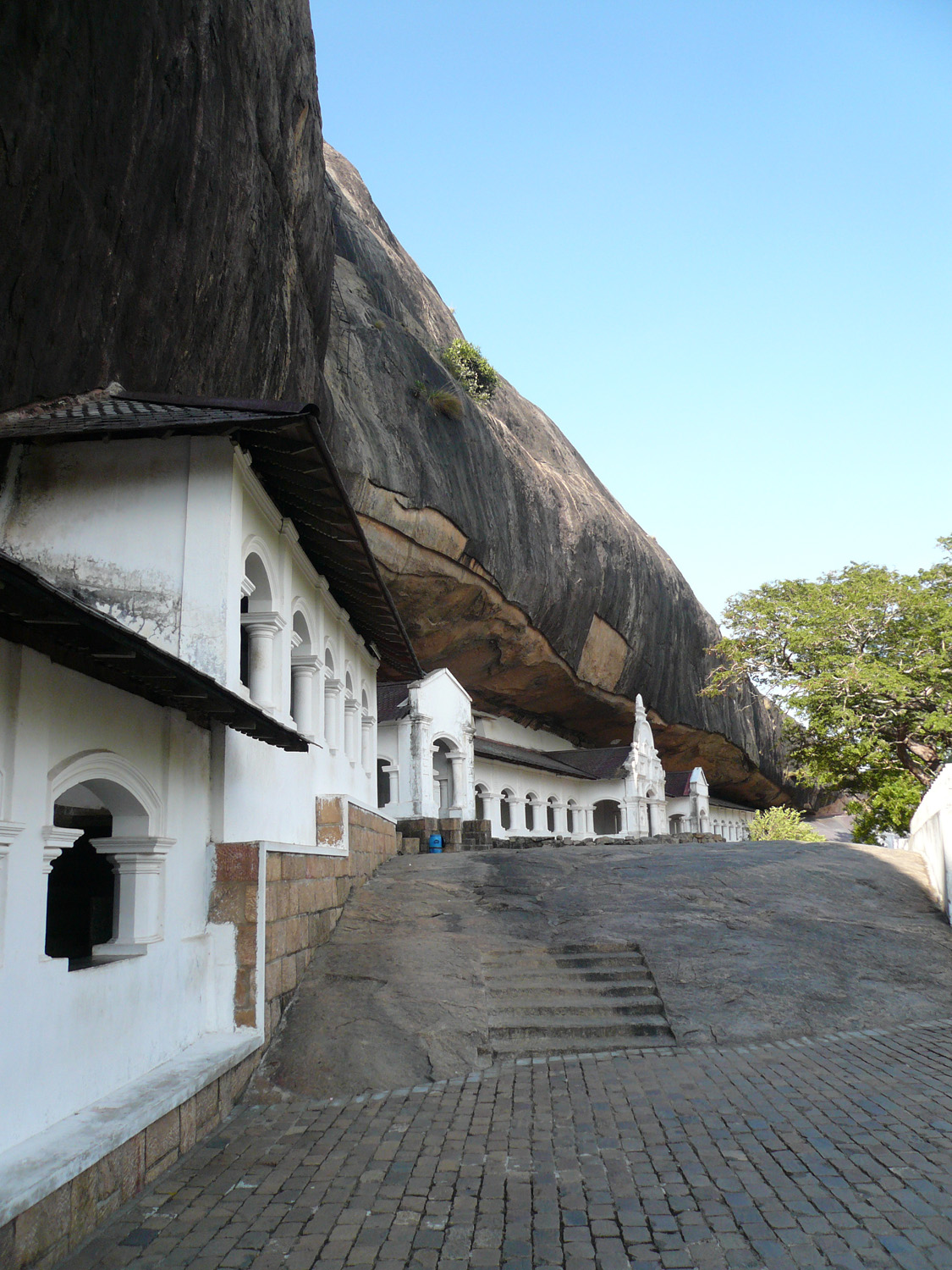
A sacred pilgrimage site for 22 centuries, this cave monastery, with its five sanctuaries, is the largest, best-preserved cave-temple complex in Sri Lanka. The Buddhist mural paintings (covering an area of 2,100 m2) are of particular importance, as are the 157 statues. Is a World Heritage Site 1991. Also known as Dambulla cave Temple in the central of the Sri Lanka country. Largest and best-preserved cave temple complex in Sri Lanka. There are major attractions on 5 caves contains of statues and paintings which are related to Lord Buddha and his life. May found 153 of Buddha statues. The two hindu god's Lord Vishnu and god Ganesh, was include later on.

The temple is composed of five caves, which have been converted into shrine rooms. The caves, built at the base of a 150m high rock during the Anuradhapura (1st Century BC to 993 AD) and Polonnaruwa times (1073 to 1250), are by far the most impressive of the many cave temples found in Sri Lanka. Read more

Information and Image Obtained From Wikipedia, the free encyclopedia and World Heritage Site.

Tuesday, September 29, 2009

Borobudur Temple Compounds

Card # 28
These postcard sent to me by Edy

There is no written record of who built Borobudur or of its intended purpose.[16] The construction time has been estimated by comparison between carved reliefs on the temple's hidden foot and the inscriptions commonly used in royal charters during the eight and ninth centuries. Borobudur was likely founded around 800 AD.[16] This corresponds to the period between 760–830 AD, the peak of the Sailendra dynasty in central Java,[17] when it was under the influence of the Srivijayan Empire. The construction has been estimated to have taken 75 years and been completed during the reign of Samaratungga in 825. Read more

Queen Maya riding horse carriage retreating to Lumbini to give birth to Prince Siddhartha Gautama.

Evidence suggests Borobudur was abandoned following the fourteenth century decline of Buddhist and Hindu kingdoms in Java, and the Javanese conversion to Islam. Worldwide knowledge of its existence was sparked in 1814 by Sir Thomas Stamford Raffles, the then British ruler of Java, who was advised of its location by native Indonesians. Borobudur has since been preserved through several restorations. The largest restoration project was undertaken between 1975 and 1982 by the Indonesian government and UNESCO, following which the monument was listed as a UNESCO World Heritage Site. Borobudur is still used for pilgrimage; once a year Buddhists in Indonesia celebrate Vesak at the monument, and Borobudur is Indonesia's single most visited tourist attraction.

Information and Image Obtained From Wikipedia, the free encyclopedia

Taman Negara Mulu, Malaysia

Card # 27 These postcard sent to me by Jasmine

Gunung Mulu National Park near Miri, Sarawak, Malaysian Borneo, is a UNESCO World Heritage Site that encompasses incredible caves and karst formations in a mountainous equatorial rainforest setting. The park is famous for its caves and the expeditions that have been mounted to explore them and their surrounding rainforest, most notably the Royal Geographical Society Expedition of 1977 - 1978, which saw over 100 scientists in the field for 15 months. Read more


Information and Image Obtained From Wikipedia, the free encyclopedia and World Heritage Center

Monday, September 28, 2009

Tapak Warisan Dunia, WHS, Malaysia

Card # 26 These postcard sent to me by Jasmine

My first WHS UNESCO postcard from Malaysia. It shows 3 WHS from M'sia.
On the top left is Banda Hilir, Melaka, Historic City of the Straits of Malacca.
The state's capital is Malacca Town. This historical city centre has been listed as a UNESCO World Heritage Site since 7 July 2008. Malacca was found by Parameswara Srivijayan prince on 1400. Another version of the story says that Parameswara chose the name 'Malacca' from the Tamil word 'mallakka' which means upside down or on ones back. In 1414 Parameswara convert to Islam and change his name to Raja Iskandar Shah. Malacca Harbor in 1831.

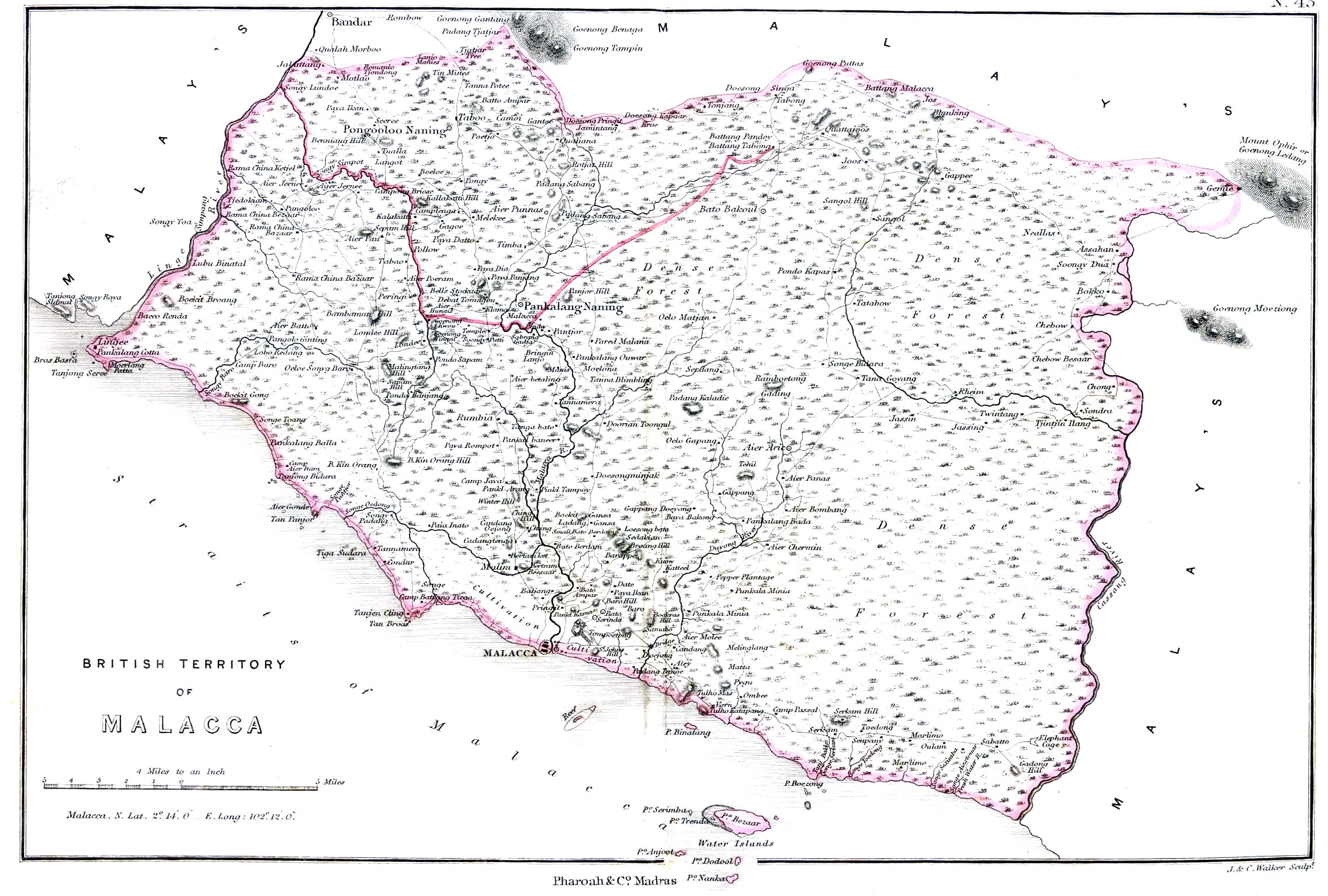
1854 map of the "British Territory of Malacca"

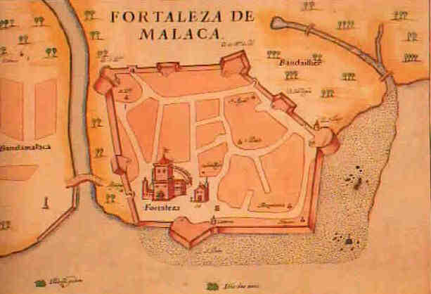
1630 map of the Portuguese fort and the city of Malacca. Read more


On the right shows Taman Kinabalu, Sabah

Kinabalu National Park or Taman Negara Kinabalu in Malay, established as one of the first national parks of Malaysia in 1964, is Malaysia's first World Heritage Site designated by UNESCO in December 2000 for its "outstanding universal values" and the role as one of the most important biological sites in the world.
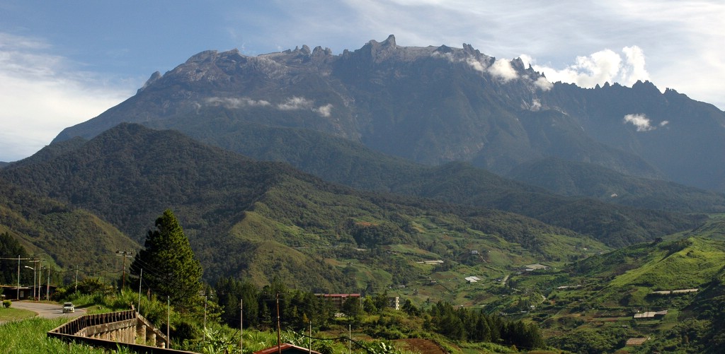
View of Mount Kinabalu from Kundasang. Read more

Located on the west coast of Sabah, east Malaysia on the island of Borneo; it covers an area of 754 square kilometers surrounding Mount Kinabalu, which at 4,095.2 metres, is the highest mountain on the island of Borneo. The park is one of the most popular tourist spot in Sabah as well as in Malaysia. In 2004, more than 415,360 visitors and 43,430 climbers visited the Park.

and on the bottom is George Town, Penang, Historic City of the Straits of MalaccaGeorge Town or Georgetown, is the capital of the state of Penang in Malaysia. Named after Britain's King George III, George Town is located on the north-east corner of Penang Island and has about 220,000 inhabitants, or about 400,000 including the suburbs.

Formerly a municipality and then a city in its own right, since 1976 George Town has been part of the municipality of Penang Island, though the area formerly governed by the city council is still commonly referred to as a city, and is also known as Tanjung ("The Cape") in Malay and 喬治市 (Qiáozhì Shì) in Chinese. The inner city of George Town is a UNESCO World Heritage Site in 2008. Most of George Town's population is of Chinese origin. George Town was founded in 1786 by Captain Francis Light, a trader for the British East India Company. The town was built on swampy land that had to be cleared of vegetation, levelled and filled.
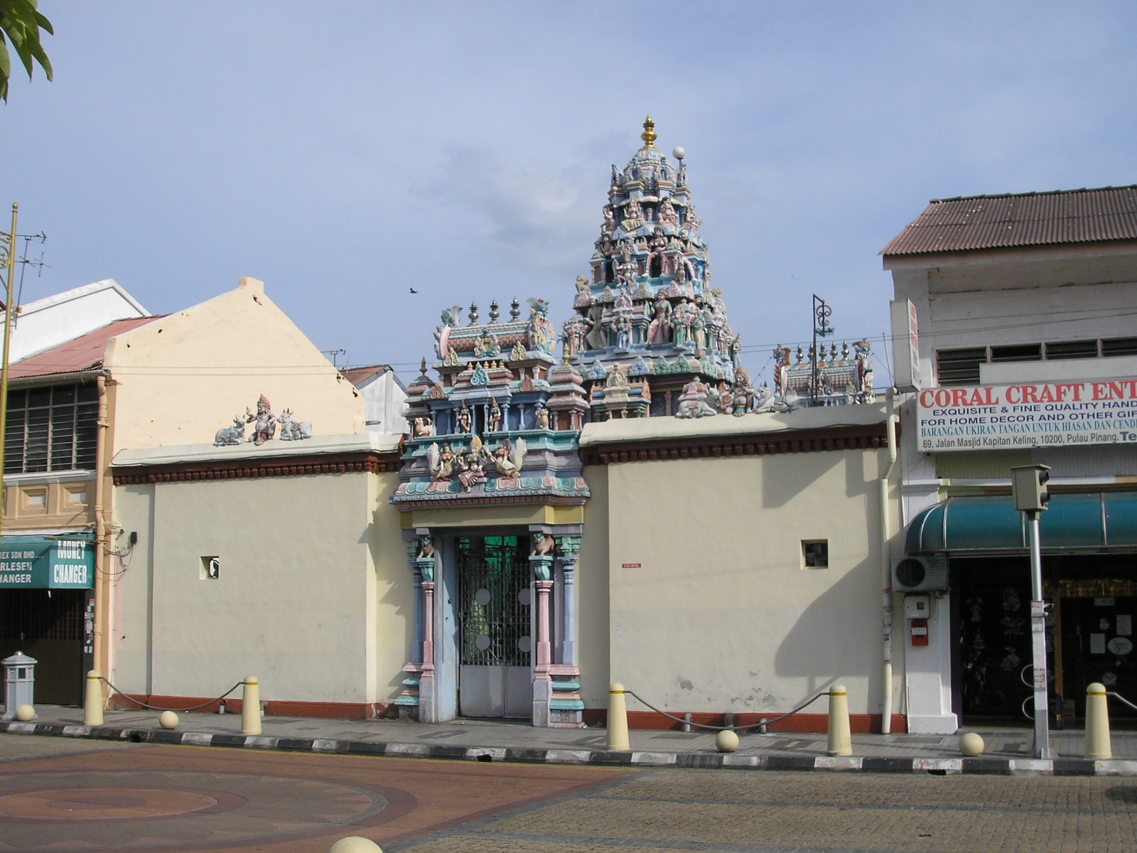
Built in 1833, the Sri Mariamman Temple is the oldest Hindu temple in Penang, Malaysia, and features fascinating sculptures of gods and goddesses over its main entrance and facade. From its inception, the temple provided an important place of worship for early Indian immigrants and is now an important cultural and national heritage. Read more

Map of peninsular Malaysia and East Malaysia (Malaysian Borneo).

Information and Image Obtained From Wikipedia, the free encyclopedia

Thursday, September 24, 2009

Historic Centre of Riga, Latvia

Card # 25
This beautiful Postcard i received from postcrossing :)

Riga's historical centre has been declared a UNESCO World Heritage Site, and the city is particularly notable for its extensive Jugendstil (German Art Nouveau) architecture, which UNESCO considers to be unparalleled anywhere in the world.

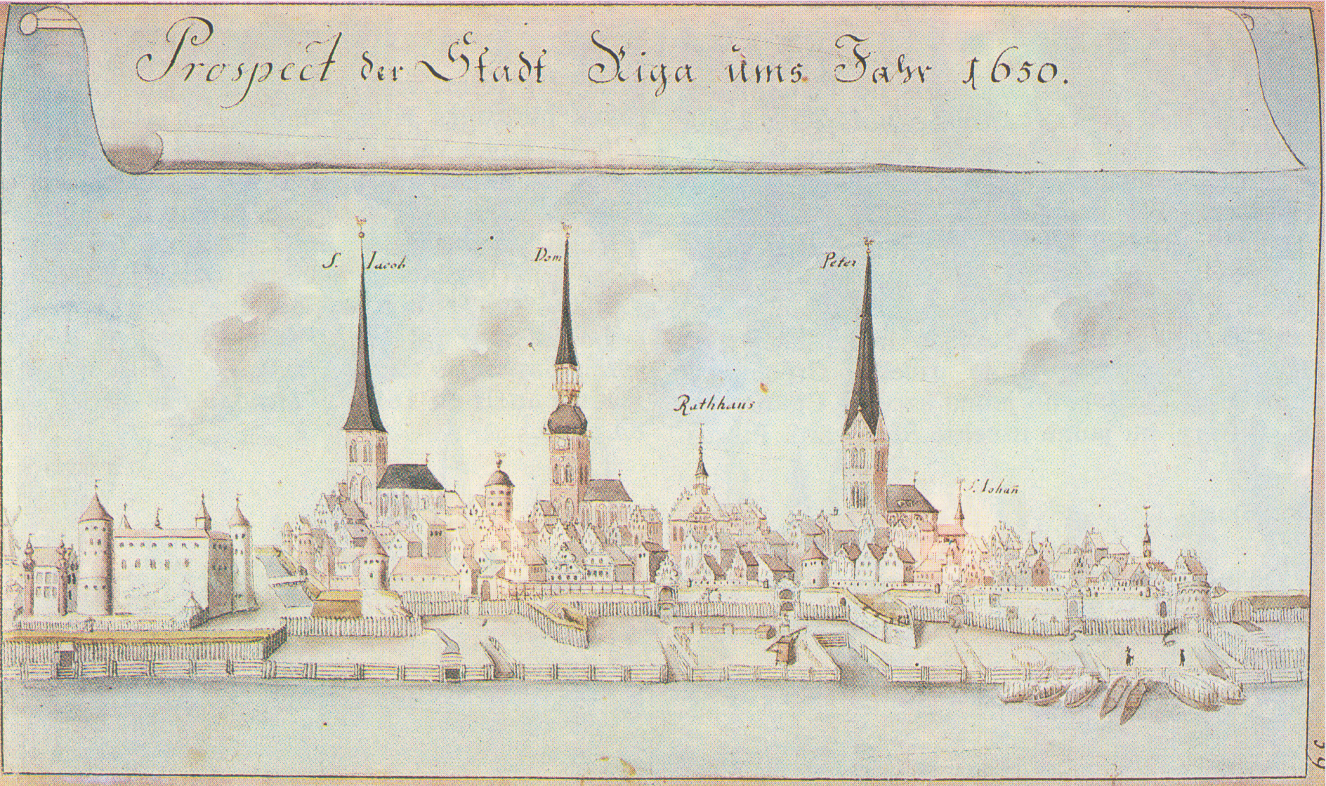
Riga in 1650. The inscription reads: Prospect der Stadt Riga ums Jahr 1650 (View at the City of Riga in the year 1650). Drawing by Johann Christoph Brotze

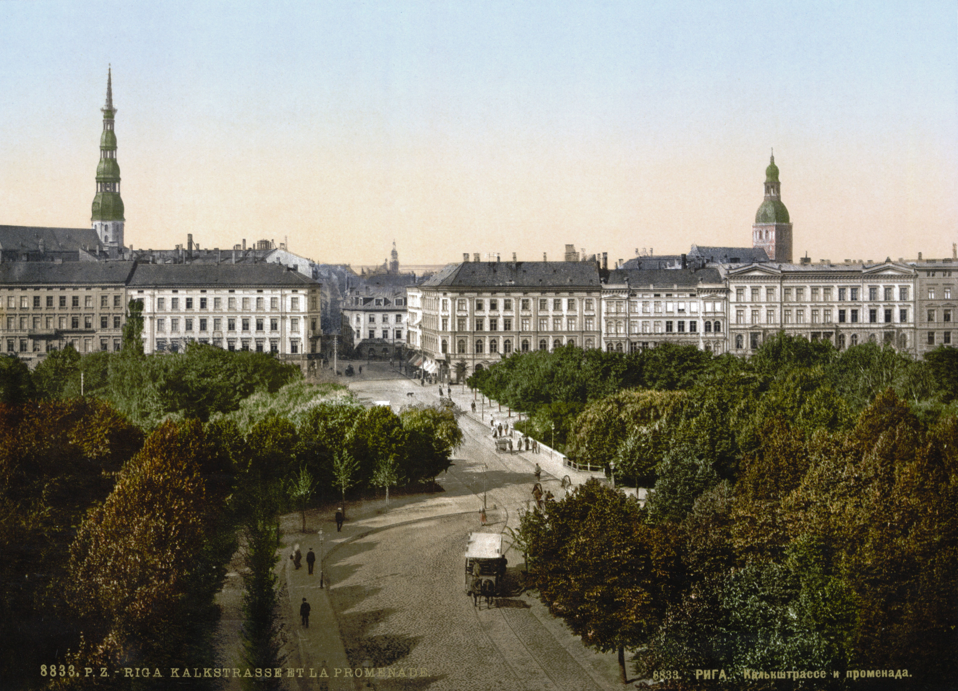
A view of Riga on a postcard. circa 1900. Read more

Wednesday, September 23, 2009

Val d'Orcia, Italy

Card # 24

These postcard sent to me by Riccardo

The Val d’Orcia, or Valdorcia, is a region of Tuscany, central Italy, which extends from the hills south of Siena to Monte Amiata. It is characterised by gentle, carefully-cultivated hills occasionally broken by gullies and by picturesque towns and villages such as Pienza (rebuilt as an “ideal town” in the 15th century under the patronage of Pope Pius II), Radicofani (home to the notorious brigand-hero Ghino di Tacco) and Montalcino (the Brunello di Montalcino is counted among the most prestigious of Italian wines). In 2004 the Val d’Orcia was added to the UNESCO list of World Heritage Sites. Read more

Sunday, September 20, 2009

The Dolomites

Card # 23 These postcard sent to me by Riccardo

The Dolomites are a section of the Alps. They are located for the most part in the province of Belluno, the rest in the provinces of Bolzano-Bozen and Trento (all in north-eastern Italy). Conventionally they extend from the Adige river in the west to the Piave valley in the east. The northern and southern borders are defined by the Puster Valley and the Sugana Valley. But the Dolomites spread also over the Piave river to the east; and far away over the Adige river to the west is the Brenta Group (Western Dolomites); there is also another smaller group called Piccole Dolomiti located between the Provinces of Trento and Vicenza.

One national park and many other regional parks are located in the Dolomites. In August 2009, the Dolomites has been declared natural heritage of the UNESCO.


During the First World War, the line between the Italian and Austro-Hungarian forces ran through the Dolomites. There are now open-air war museums at Cinque Torri (Five Towers) and Mount Lagazuoi. Many people visit the Dolomites to climb the Vie ferrate, protected paths created during the First World War. A number of long distance footpaths run across the Dolomites, which are called "Alte vie" (i.e., high paths). Such long trails, which are numbered from 1 to 8, require at least a week to be walked through and are served by numerous "Rifugi" (huts). The first and, perhaps, most renowned is the Alta Via 1.

Information and Image Obtained From Wikipedia, the free encyclopedia

Wednesday, September 16, 2009

Historic Centre of Siena

Card # 22
These postcard sent to me by Riccardo

Siena, like other Tuscan hill towns, was first settled in the time of the Etruscans (c. 900 BC to 400 BC) when it was inhabited by a tribe called the Saina. The Etruscans were an advanced people who changed the face of central Italy through their use of irrigation to reclaim previously unfarmable land, and their custom of building their settlements in well-defended hill-forts. Then, at the time of the Emperor Augustus, a Roman town called Saena Julia was founded in the site. The first document mentioning it dates from AD 70. Some archaeologists assert it was controlled for a period by a Gaulish tribe called the Saenones. This beautiful historical place declared by UNESCO World Heritage Sites in year 1995. Read more

Medieval coin from Siena (12th century).

Information Obtained From Wikipedia, the free encyclopedia

Tuesday, September 15, 2009

Cappadocia and Uchisar- Turkey

Card # 211. Uchisar Koyu- Uchisar Village
2. Gorkun Dere Vadisi- Gorkun Dere Valley
3. Kaya Formasyonlari- Rock Formation

Uchisar Kaya Yerlesmeleri- Uchisar Rock-cut settlements

These postcard was sent to me by my friend Cuneyt Ozarikan

Cappadocia, the name was traditionally used in Christian sources throughout history and is still widely used as an international tourism concept to define a region of exceptional natural wonders characterized by fairy chimneys (image below) and a unique historical and cultural heritage. The term, as used in tourism, roughly corresponds to present-day Nevşehir Province of Turkey.

Cappadocia's limits are debated. In the time of Herodotus, the Cappadocians are supposed to have occupied the whole region from Mount Taurus to the vicinity of the Euxine (Black Sea). Cappadocia, in this sense, was bounded in the south by the chain of Mount Taurus, to the east by the Euphrates, to the north by Pontus, and to the west by Lake Tuz, in Central Anatolia. But Strabo, the only ancient author to provide a major account of the area, greatly exaggerated its dimensions. It is now believed that 400 km (250 mi) east-west by 200 km (120 mi) north-south is a more realistic appraisal of Cappadocia's area.

The earliest record of the name of Cappadocia dates from the late 6th century BC, when it appears in the trilingual inscriptions of two early Achaemenid kings, Darius I and Xerxes, as one of the countries which are part of the Persian Empire. Read more

Uchisar is situated at the highest point in the region, on the Nevsehir-Goreme road, just 7 km from Nevsehir. It is not known when Uchisar was first inhabited , however, in style, it resembles Ortahisar and the Selime Kalesi (castle) in the Ihlara Region. The top of the citadel provides a magnificent panorama of the surrounding area. Many rooms hollowed out into the rock are connected to each other with stairs, tunnels and passages. At the entrances of the rooms, there are millstone doors, just like the ones in the underground settlements, used to control access to these places. Due to the erosion in places of this multi-leveled castle, it is unfortunately not possible to reach all the rooms. The fairy chimneys to the west, east and north of Uchisar were hollowed out and used as graves during the Roman period. Inside these rock cut tombs, the entrances of which generally face west, are klines or stone slabs on which the bodies were laid. Many rock cut churches have been discovered not only on the skirts of the castle but also inside it. The reason for this may be the fact that Goreme, having numoreus churches and monasteries, is very close to Uchisar. The simple Byzantine graves on top of the castle are not very interesting due to the fact that they have been eroded and ransacked. It is said that in towns with citadels, e.g. Uchisar, Ortahisar and Ürgüp (Bashisar), long defense tunnels reached far into the surrounding areas. However, since the tunnels have collapsed in places, this theory cannot be confirmed, but is a popular myth as to the great distances they cover. Read more
Information obtained from Cappadocia online and Wikipedia, the free encyclopedia

LinkWithin

Related Posts with Thumbnails